Pachyderm Arch Out and Back

Map of Pachyderm Arch Out and Back, Red River Gorge

Elevation Profile of Pachyderm Arch Out and Back, Red River Gorge
Overview. This is a beautiful arch that certainly calls elephants to mind. Though the walk is relatively easy, the class 3 scramble to reach the arch is on steep soil with extremely poor footing. I wouldn’t try this without rope. Thank you to Red River Underground for the hike idea.
Route Type | Out and Back
Total Distance | 1.26 miles
Elevation Gain | 180 feet
Overall Difficulty | Easy with a Class 3 Scramble
this hike is on unmarked, unmaintained user trails; use extreme caution - especially on the scramble
GPS Waypoints
Unmarked Trailhead | 37.791306, -83.596461
Turn 1 | 37.793328, -83.596717
Turn 2 | 37.793456, -83.598333
Pachyderm Arch | 37.797381, -83.599275
Red River Gorge Area Map
Parking. Limited parking is available at the Wildcat Parking Lot off KY-715 and is sometimes full on busy weekends.
Trail Navigation. Go off the back (northwest) side of the parking lot and descend on the wide user trail that is primarily used for reaching a number of campsites. Reach the first fork and turn left, passing a distinct, large downed tree on your right. Continue until reaching a very large campsite and make a sharp right. From here, the trail narrows a bit and gets a little brushy, but remains very clearly defined singletrack. Ascend to the top of the ridge before the trail meanders left and down before going out and up to the edge of the ridgeline. The arch is just below this spot that has a baby class 2 scramble before the real deal scramble at the arch. I tied off 50 ft. of 600 lb. test paracord to the large tree here before descending to the arch. The soil is steep and loose above the arch. There is another scramble route that begins maybe 15-20 feet away. I judged the risk to be lower by tying off to a solid tree and making a shorter descent. Once at the arch, enjoy the view from all the way around it. When ready, make your way back up the steep slope and retrace your steps back to the parking lot.
HIKER NOTE - Better When Dry. The soil was still pretty moist when we visited, so we used paracord to negotiate the final bit to the arch. Dry conditions would certainly make for an easier time.
CAUTION - Class 3 Scramble. The scramble to reach the arch is on very steep soil with extremely poor footing - especially when wet. Bring some rope to set a handline around the big tree above the arch and make your hike safer. I used 50 ft. of 600 lb. test paracord to set a handline. These handlines are to offload 20% or so of my weight while maintaining a balanced posture traversing the steeps.
CAUTION - Deadly Drops. Long falls from high places are the #1 non-health related cause of death for hikers in Kentucky. Keep your distance from the edges of cliffs to avoid a deadly fall. Young children should be kept close.
CAUTION - Poisonous Snakes. Copperheads and timber rattlesnakes can be found in the area. Should you encounter one, stop and slowly back away. Always give venomous snakes a wide berth. Know Before You Go => University of Kentucky Venomous Snake Guide
CAUTION - Black Bears. Ursus Americanus - a.k.a. the American black bear is growing in population throughout much of Kentucky. Know Before You Go => US Forest Service Black Bear Safety Tips
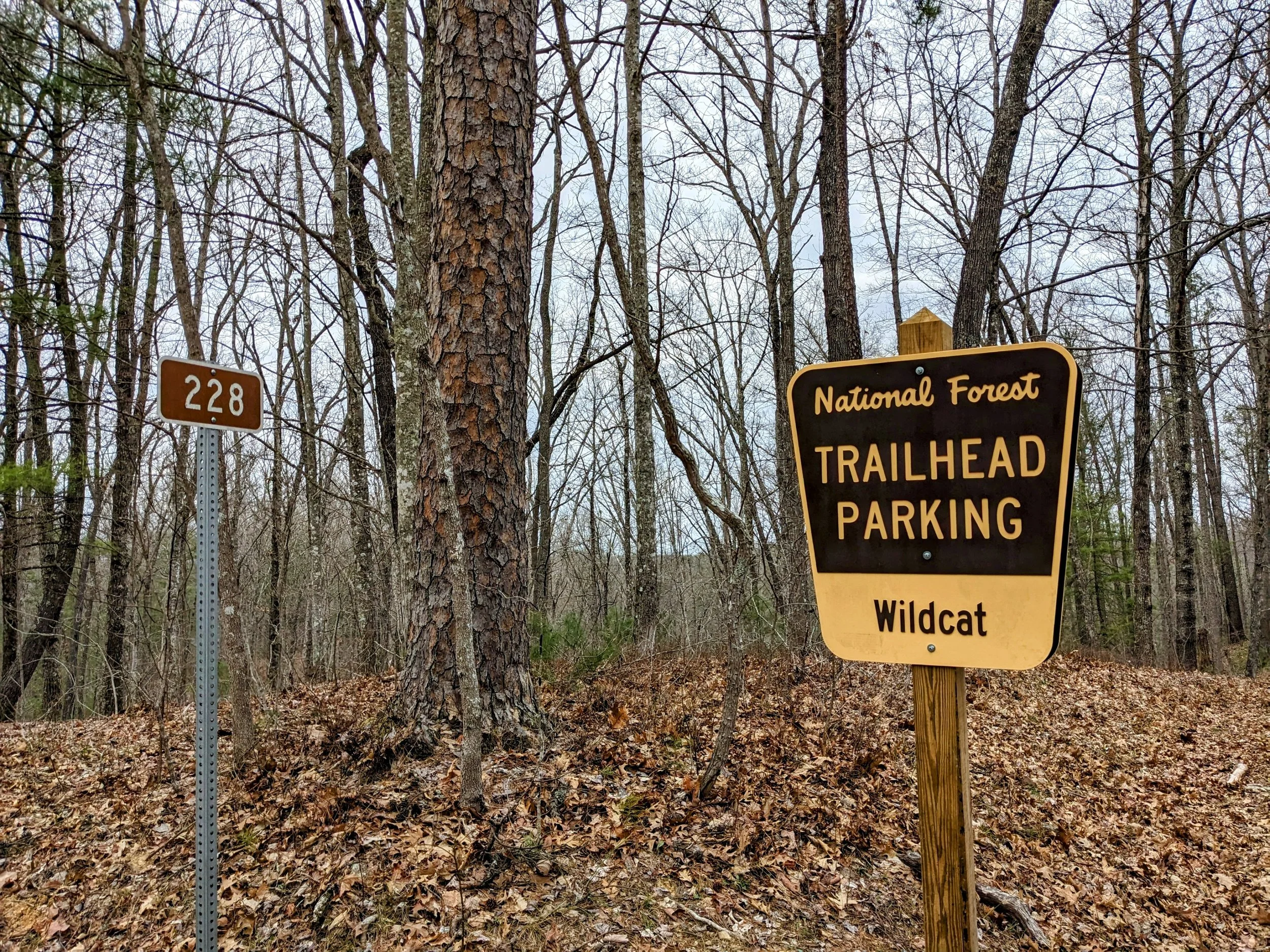
Wildcat Parking Lot and Trailhead

Back of the Lot to Primitive Camping and Pachyderm Arch

First Fork - Take a Left

Good Marking Tree - You’re on the Right Path

Sharp Right at this Big Campsite

LaFonda Scrambling Down to Pachyderm Arch with Paracord in Hand

Pachyderm Arch Approach View

Pachyderm Arch from Behind

Pachyderm Arch Side View