Martin’s Fork Mid Loop and Overlooks

Map of Martin's Fork Mid Loop and Overlooks, Red River Gorge

Elevation Profile of Martin's Fork Mid Loop and Overlooks, Red River Gorge
Overview. This is a classic route in Red River Gorge that arguably includes the geological area’s most beautiful arch and overlook at Gray’s Arch and Hanson’s Point, respectively. This hike adds three other overlooks, a playful arch, and a little archaeological history as well. If you’re looking for a nice half-to-full day hike to get to know Red River Gorge, this is a great one.
Route Type | Loop and Spurs
Total Distance | 11.06 miles
Elevation Gain | 2,399 feet
Overall Difficulty | Moderate with Class 2 Scrambles
*the overlooks are on unmarked/unmaintained trails, be sure to save the waypoints below and import the .gpx or .kml file to your preferred navigation app
GPS Waypoints
Parking Lot | 37.820247, -83.666886
Martin’s Fork Trailhead | 37.819503, -83.667339
Rough Trail Stepped Overlooks (4) | 37.809008, -83.661961
Junction with Gray’s Arch Trail | 37.808953, -83.660511
Turn to Military Wall Overlook | 37.814906, -83.660625
Military Wall Overlook | 37.815425, -83.665078
Mid-Level Arch | 37.817942, -83.657719
Spur to Gray’s Arch | 37.817703, -83.658092
Gray’s Arch | 37.816986, -83.658031
Turn to The Veranda | 37.819236, -83.645575
The Veranda | 37.818119, -83.641011
Junction with Rush Ridge Trail | 37.819181, -83.645906
Junction with Tunnel Ridge Road | 37.807333, -83.655978
D Boon Hut Trailhead | 37.807409, -83.657879
Turn to D Boon Hut | 37.807717, -83.663525
Red River Gorge Area Map
Parking. Limited parking is available at the Martin’s Fork parking lot on KY-77 (Nada Tunnel Road). This lot frequently fills up over the weekends from Spring through Fall.
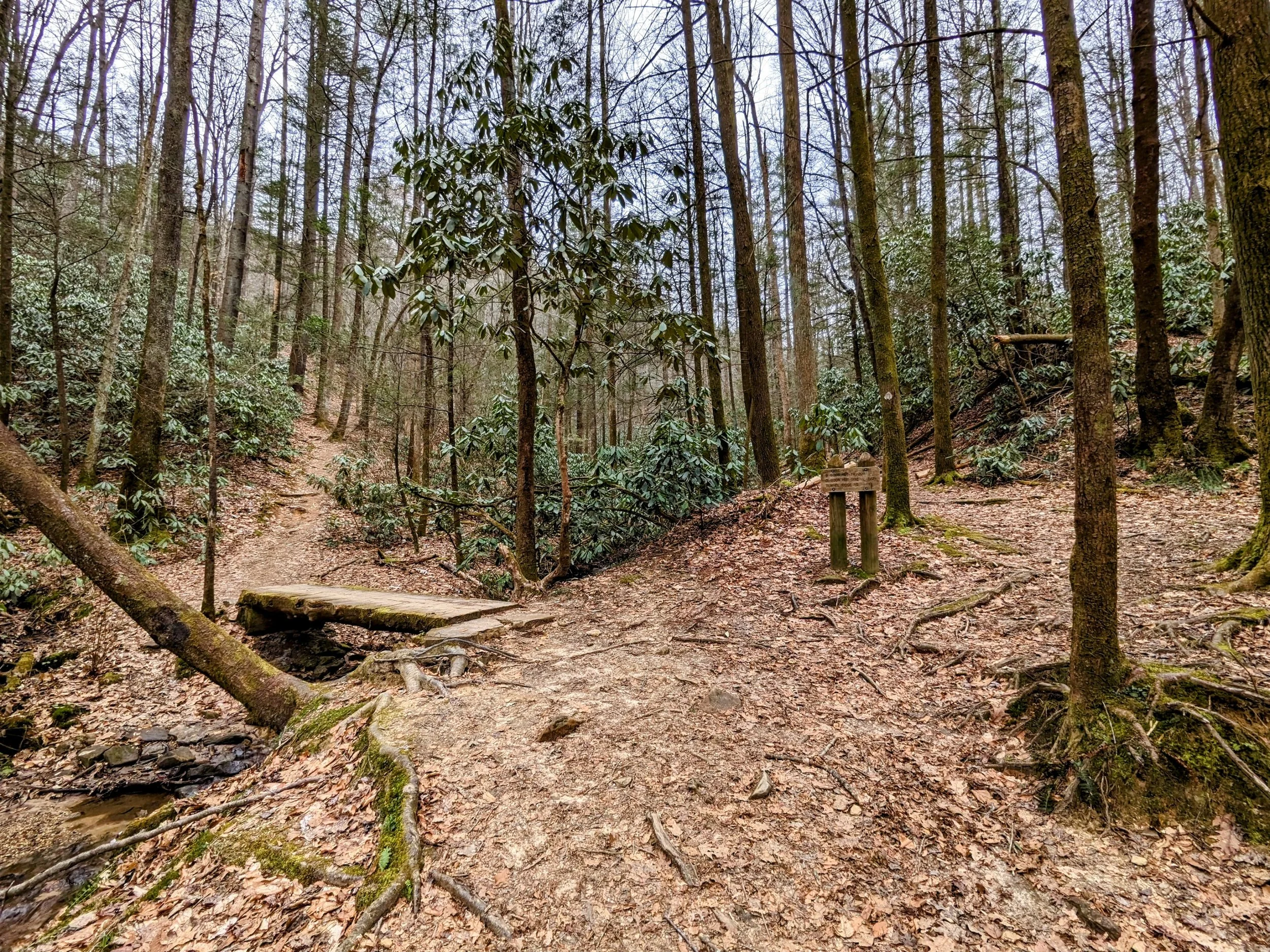
Trail Navigation. This hike uses a combination of marked/maintained and unmarked/unmaintained trails. Be sure to download the waypoints above and import the .gpx or .kml files to your preferred navigation app. All paths are well worn and relatively easy to follow. The spur to Military Wall Overlook is brushier than the others, so be sure to wear bug repellant and long pants are nice. To hike this route:
Start at the Martin’s Fork Parking Lot and walk southwest on KY-77
Locate the trailhead and cross the footbridge on Rough Trail
Continue past the marked intersections with Military Wall Trail (right) and Left Flank (left)
Reach the intersection with D. Boon Hut Trail and fork left (southeast)
Climb the first of three ridges and top out at a large, illegal campsite
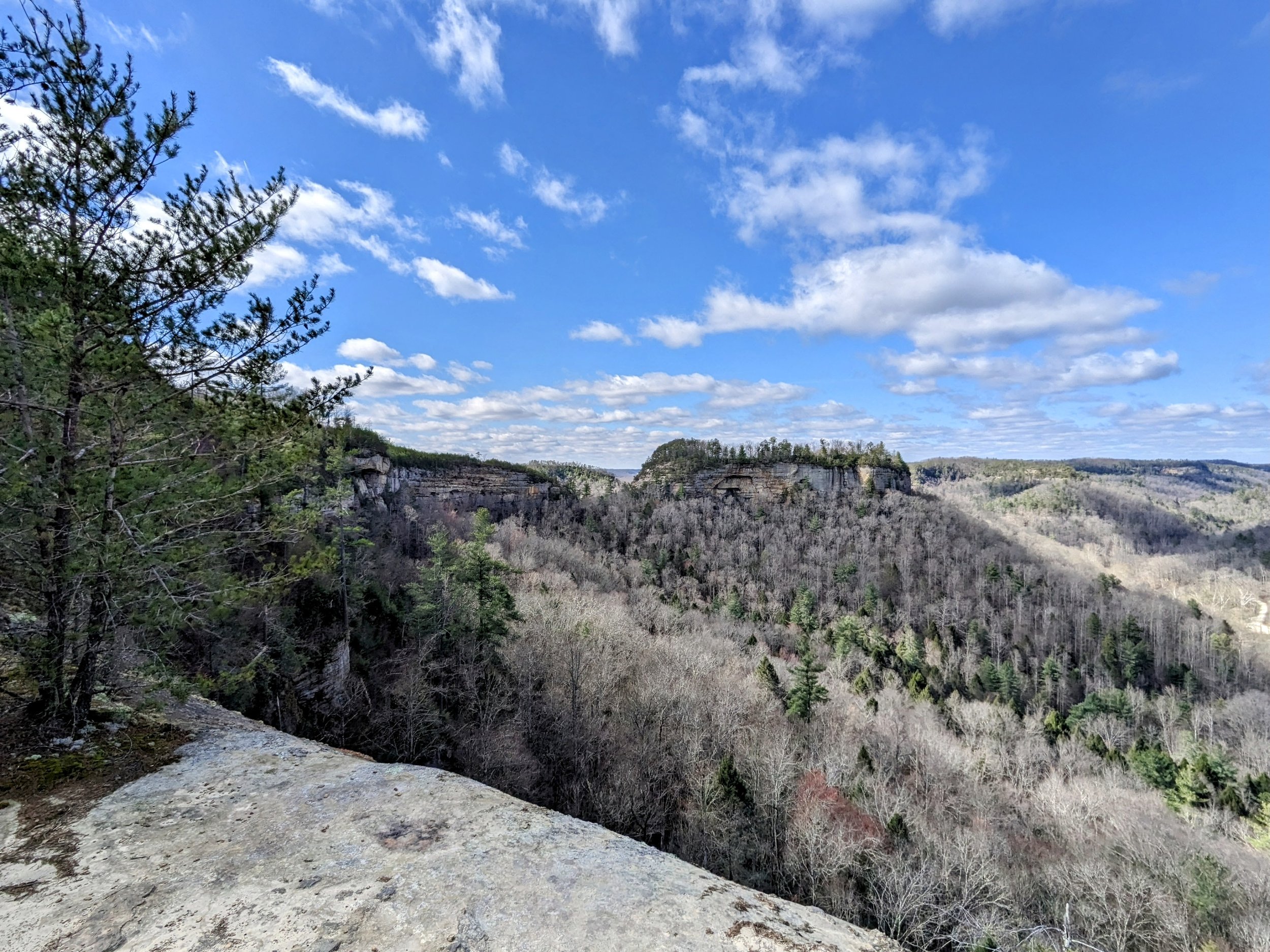
Make a left (northwest) here to walk a few dozen paces through the campsite to Martin’s Fork Overlook that has a nice view of Military Wall across the hollow and a distant view of Ravens Rock
Retrace your steps to Rough Trail and turn left (northeast)
Turn left (north-northwest) at the junction with Gray’s Arch Trail
Walk the ridge about a half mile keeping your eyes left to find a massive downed tree with a well-defined trail - this is the path the Military Wall Overlook
Continue on the user path to a campsite and make a left to continue to descend to the overlook
Retrace your steps and turn left (northeast) on Rough/Gray’s Arch Trail to descend shortly before reaching an unmarked intersection
Take the left fork to stay on trail (going straight leads to the top of Gray’s Arch)
Descend a staircase and then another; at the base of the second staircase, make a sharp left to find Mid-step Arch
Return to the trail and continue descending another staircase
Go straight at the junction where Rough Trail diverges
Look up and to the right to see Little Gray’s Arch; circle around at the base of the rock shelter and ascend to Gray’s Arch - it is best to place your feet on the flat spots atop the narrow/pointy rock and use your hand to balance on the rock wall beside you
Return to the junction with Rough Trail and fork right to continue the loop
Descend on Rough Trail and reach a slick section that is King Branch; take care here to find the safest route with flat footplants; when going downhill, lower your center of gravity to maintain balance
Begin climbing and reach the top of the ridge and the intersection with Rush Ridge Trail; continue past it maybe 30-ish paces to find a stay on trail flatstick
Instead of descending on Rough Trail, take the well defined path straight and follow the widest, most packed down path to The Veranda
Retrace your steps and turn left on Rough Trail to descend only to climb once again
Short of the top of the next ridge, look left and find a wide path on your left; take it out to Hanson’s Point taking a right at all but the next to last one of the campsites; you might make a few false steps here, but it’s easy to backtrack to the main trail
Enjoy Hanson’s Point and return to Rough Trail
Make a left and ascend for a very short while before reaching the intersection with Pinch ‘em Tight Trail. Turn right (west) to follow the ridgeline to Tunnel Ridge Road; your climbing is finished at this point - nice work!
Turn right on Tunnel Ridge Road and locate the second entrance to Gray’s Arch Picnic Area - D. Boon Hut Trail
Descend on the marked trail and follow the white diamond blazes; there is a side trail near a rock shelter where white haired goldenrod grows - this is a side trail and can be skipped unless you want to visit yet another rock shelter
Continue around the cliff line and ascend to your left on the signed spur to D. Boon Hut
Read the signs, take in the fenced off scene, and then look out from the massive rock shelter for a spectacular forest scene
Retrace your steps to the main trail and turn left to finish your descent back to the parking lot
CAUTION - Deadly Drops. Long falls from high places are the #1 non-health related cause of death for hikers in Kentucky. Keep your distance from the edges of cliffs to avoid a deadly fall. Young children should be kept close.
CAUTION - Poisonous Snakes. Copperheads and timber rattlesnakes can be found in the area. Should you encounter one, stop and slowly back away. Always give venomous snakes a wide berth. Know Before You Go => University of Kentucky Venomous Snake Guide
CAUTION - Black Bears. Ursus Americanus - a.k.a. the American black bear is growing in population throughout much of Kentucky. Know Before You Go => US Forest Service Black Bear Safety Tips

Martin’s Fork Parking Lot

Rough Trailhead (west)

Rough Trail (left), Military Wall Trail (right)

Left Flank Trail (left), Rough Trail (right)

A little water flow on Martin’s Branch
Rough Trail (left), D. Boon Hut Trail (right)

Martin’s Fork (Branch) Overlook from below

Martin’s Fork (Branch) Overlook

Rough Trail/Gray’s Arch Trail (left), Gray’s Arch Trail to Picnic Area (right)

Stay on Trail

Turn to Military Wall Overlook (left)

Looking out to Military Wall

Ravens Rock way off in the distance

Second staircase going down

Mid-step Arch back view

Little Gray’s Arch

Gray’s Arch through the sticks

Rest in peach, Jim!

Gray’s Arch back view

Rough Trail Junction - left to Tunnel Ridge Road, right to continue the loop


Some trailside water

Rough Trail (left), Rush Ridge Trail (right)

Go straight past this sign to reach The Veranda

View east-northeast to Pinch ‘em Tight from The Veranda

View south from The Veranda

Past this rock shelter is the slickest part of the trail; use caution here

“Hanson’s Point Trail” (left), Rough Trail (right)

Clouds finally starting to break

One of the massive campsites en route to Hanson’s Point
Pinch ‘em Tight Gap

Looking out to Chimney Top Rock

Hanson’s Point

PInch ‘em Tight Trail (right), Rough Trail (left) - go right to finish the loop

Your climbing is finished for the day; take the flat ridge to Tunnel Ridge Road

Pinch ‘em Tight Trail (straight), Rush Ridge Trail (sharp right)

Coming out on Tunnel Ridge Road

Gray’s Arch Picnic Area

D. Boon Hut Trailhead at Gray’s Arch Picnic Area

Plenty of steps to D. Boon Hut

Signed spur to D. Boon Hut

D. Boon Hut rock shelter

Archaeology

Forest view from D. Boon Hut rock shelter