Martin’s Branch (Fork) Overlook Out and Back

Map of Martin's Branch Overlook Out and Back, Red River Gorge

Elevation Profile of Martin's Branch Overlook Out and Back
Overview. This is a quick walk to a nice view of the Martin’s Branch/Fork drainage from just off Rough Trail. This hike is alright alright if you’re camping nearby - there are better views to be had, but not for so little effort.
Route Type | Out and Back
Total Distance | 0.74 miles
Elevation Gain | 124 feet
Overall Difficulty | Easy
GPS Waypoints
Gray’s Arch Trailhead | 37.808197, -83.657497
Gray’s Arch-Rough Trail Junction | 37.809108, -83.659886
Large Illegal Campsite | 37.808842, -83.660706
Martin’s Branch Overlook | 37.809014, -83.661925
Red River Gorge Area Map
Parking. A good number of spaces are available at the picnic area, in the adjoining D Boon Hut Lot, and across the street at Archaic. Weekends fill up fast. Arrive early or late when hiking this Spring through Fall or consider a shuttle from Leave No Trace Adventures. Parking on Tunnel Ridge Road is prohibited except where designated and tickets have been issued in the past.
Trail Navigation. Begin at the Gray’s Arch Trailhead by the old pit toilets. Continue the flat walk past the meadow and reach the junction with Rough Trail. Turn left and go through a small stand of young trees to reach a large, heavily impacted, and illegal trailside campsite. Go right and across diagonally to pick-up the spur to the overlook. Enjoy the views north and west before retracing your steps to the trailhead.
HIKER NOTE - Sunset. You can catch sunset here, but arrive much earlier than the posted sunset time. The overlooks sits at a lower elevation compared to the ridge across the hollow, so get here at least 30 minutes early. Full disclosure - this isn’t the best sunset spot, but it’ll do in a pinch.
HIKER NOTE - Roadside and Trailside Overlooks of the Same Name. Forest Service has posted signs at each of the two roadside overlooks on Tunnel Ridge Road with one named Martin’s Branch Overlook. The hike here is for the trailside overlook that can be seen from the roadside overlook and vice versa.
CAUTION - Deadly Drops. Long falls from high places are the #1 non-health related cause of death for hikers in Kentucky. Keep your distance from the edges of cliffs to avoid a deadly fall. Young children should be kept close.
CAUTION - Poisonous Snakes. Copperheads and timber rattlesnakes can be found in the area. Should you encounter one, stop and slowly back away. Always give venomous snakes a wide berth. Know Before You Go => University of Kentucky Venomous Snake Guide
CAUTION - Black Bears. Ursus Americanus - a.k.a. the American black bear is growing in population throughout much of Kentucky. Know Before You Go => US Forest Service Black Bear Safety Tips

Gray's Arch Picnic Area and Trailhead

Jim Graf Memorial and Warning Sign

Rough Trail - Gray's Arch Trail Junction

Large Trailside Illegal Campsite
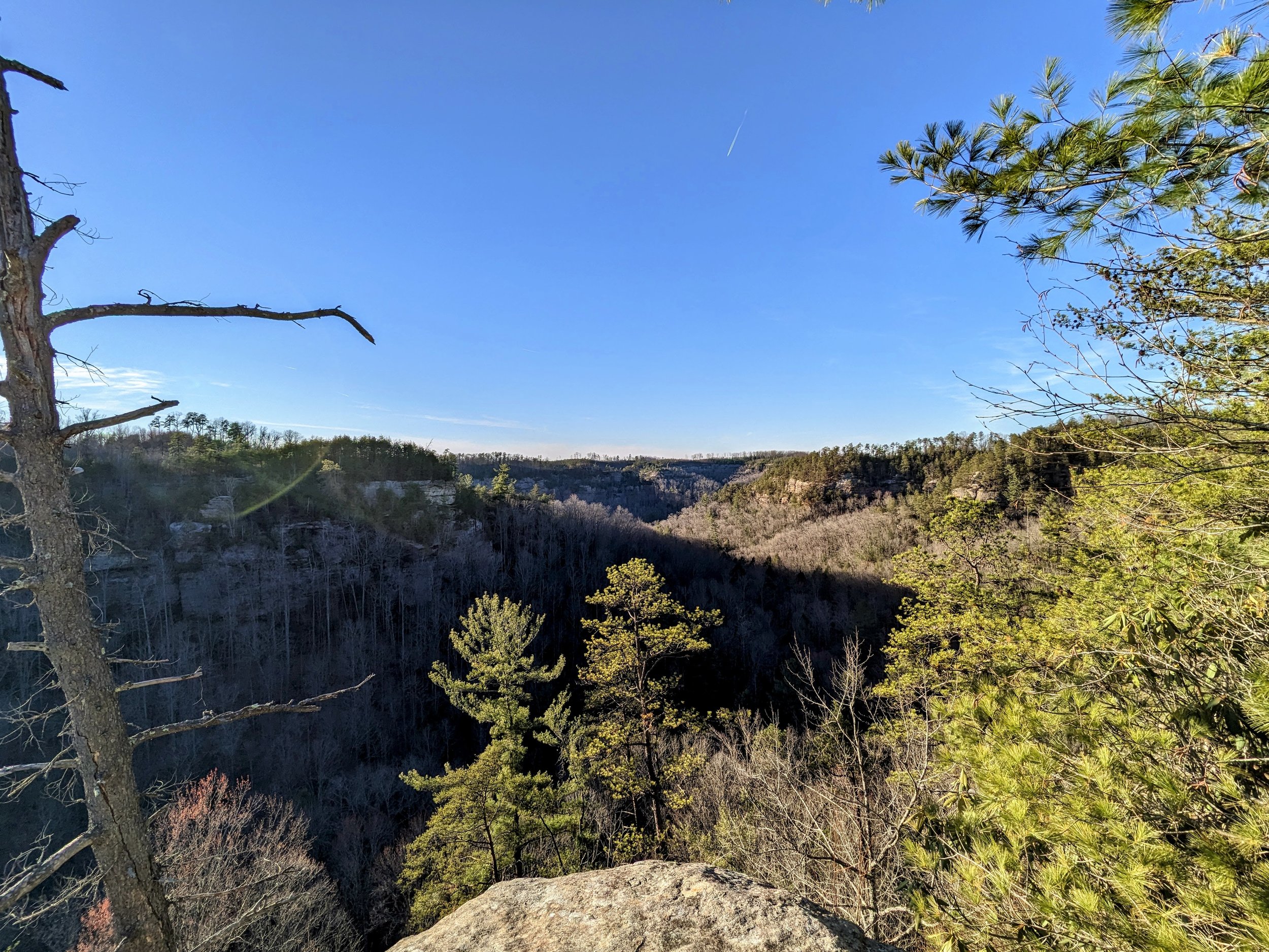
View North of Martin's Branch Watershed

View West from Martin's Branch Overlook