Buzzards Roost North, Central, and South

Map of Buzzards Roost North Central and South, Red River Gorge

Elevation Profile of Buzzards Roost North Central and South, Red River Gorge
Overview. This is a great trio of overlooks with each providing a unique view of Red River Gorge. North looks out over the river, to Hens Nest, and to Sky Bridge; Central has perhaps the best view looking downriver; South is the most iconic of the group with a spicy scramble down Keystone Arch and excellent sunset view. Skip the scramble if you’re not 100% comfortable; solid views are available without it!
Route Type | 3-Finger Out and Back
Total Distance | 1.21 miles
Elevation Gain | 348 feet
Overall Difficulty | Moderate with Class 3/4 Scramble & Bushwhacking
this hike is on unmarked trail with the spur to Buzzards Roost North crossing a post-fire recovery zone with deadfall littering the former trail
GPS Waypoints
Unmarked Trailhead | 37.816219, -83.585164
First Fork | 37.816539, -83.585719
Buzzards Roost North | 37.820211, -83.584692
Buzzards Roost Central | 37.818228, -83.585581
Keystone Arch Scramble | 37.816972, -83.587919
Buzzards Roost South | 37.816969, -83.588511
T-Intersection | 37.816675, -83.586058
Red River Gorge Area Map
Parking. Ample parking is available at the Sky Bridge Picnic Area that is rarely full.
Trail Navigation. Locate the unmarked trailhead at the far end of the parking lot you entered. Take the first well defined fork to the right (north) and follow the user trail north-northeast until reaching the fire recovery area where the trail is quickly obscured by overgrowth and deadfall. Route finding here is relatively easy, but time consuming. Navigate until reaching the top of the ridge where the surrounding landscape comes into view. Follow the ridge out to the end from here in a north-northwesterly direction. An exposed rock away from the cliff’s edge is available and a nice sit spot. To reach Buzzards Roost North, locate the cliff’s edge by finding the line of exposed rock and following it to its northern end to a defining piece of rock that is the north roost. Retrace your steps out of the fire recovery zone and back uphill to reach Buzzards Roost Central a short descent from the main trail on your right (west). Return to the main trail and go back south-southwest until the trail begins to descend steeply toward Buzzards Roost South. Follow the finger of the ridge to the top of Keystone Arch where you will need to execute a class 3/4 scramble down the south side of the arch (north side is death). The best technique here is to wedge your body sideways using counter pressure and available holds in the rock until scooting your way to the bottom. A fall here can result in serious injury or death, so be sure with your hands and feet. Skip this if you’re not comfortable, decent views are available without this scramble. Once you’ve finished the scramble, explore the rock shelter to the south or continue west to reach Buzzards Roost North. There is a hole just off the trail that looked sketch AF near the rock shelter, so take care not to tumble here. After you’ve taken in the sights, retrace your steps and take the first wide path on your right to return to the parking lot.
CAUTION - Class 3/4 Scramble. You’ll need to use all four limbs to negotiate the scramble that leads to the roost, and a tumble here can result in death - thus the Class 4 part for exposure risk. It is manageable, however, without too much trouble for experienced hikers.
CAUTION - Deadly Drops. Long falls from high places are the #1 non-health related cause of death for hikers in Kentucky. Keep your distance from the edges of cliffs to avoid a deadly fall. Young children should be kept close.
RULE REMINDER - Day Use ONLY. No camping is permitted here - and that’s a good thing. Rather than clogging up parking with campers and backpackers, you’ll find plenty of spots early morning and late afternoon even on busy weekends.
CAUTION - Poisonous Snakes. Copperheads and timber rattlesnakes can be found in the area. Should you encounter one, stop and slowly back away. Always give venomous snakes a wide berth. Know Before You Go => University of Kentucky Venomous Snake Guide
CAUTION - Black Bears. Ursus Americanus - a.k.a. the American black bear is growing in population throughout much of Kentucky. Know Before You Go => US Forest Service Black Bear Safety Tips

The hike begins at the far end of the parking lot

First fork, go right for Central and North; go left for South

Fire recovery zone on the route to Buzzards Roost North

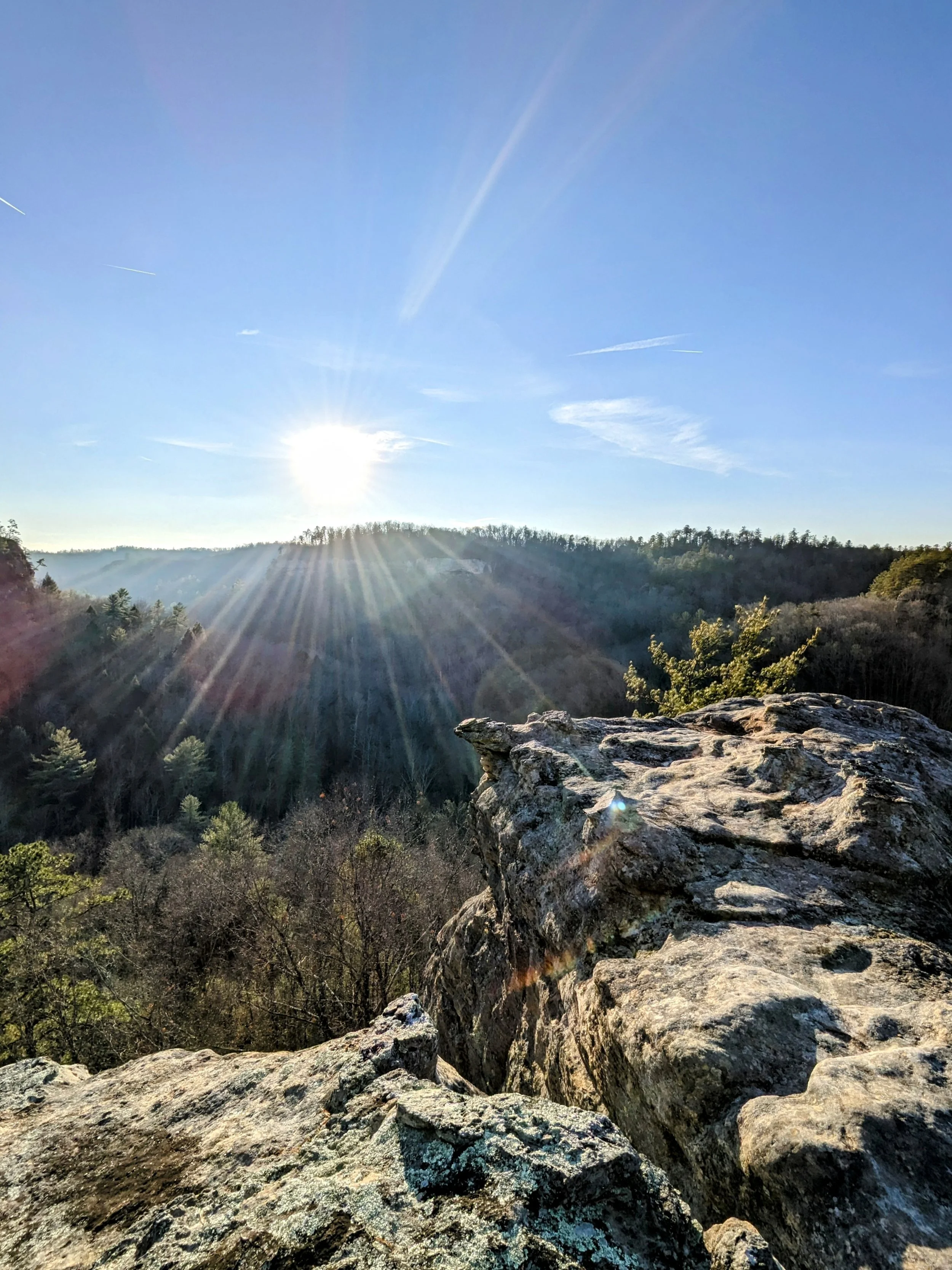
Looking back at the sun over a field of fire remnants

A nice piece of rock with a view thanks to the fire

One of the most delicate pillar windows you’ll ever see

Looking out toward Hens Nest with a large patch of clifftop rock

Looking North from Buzzards Roost North

Quick look back at the Winter sun

Red River (left) and Hens Next (right)

Gorge view from Buzzards Roost Central

Looking out to the sun with Buzzards Roost South hidden by the tree

Sun and river gorge views

Cool patch of sandstone below Keystone Arch

Gun barrel pattern in the sandstone - same as inside Sky View Arch

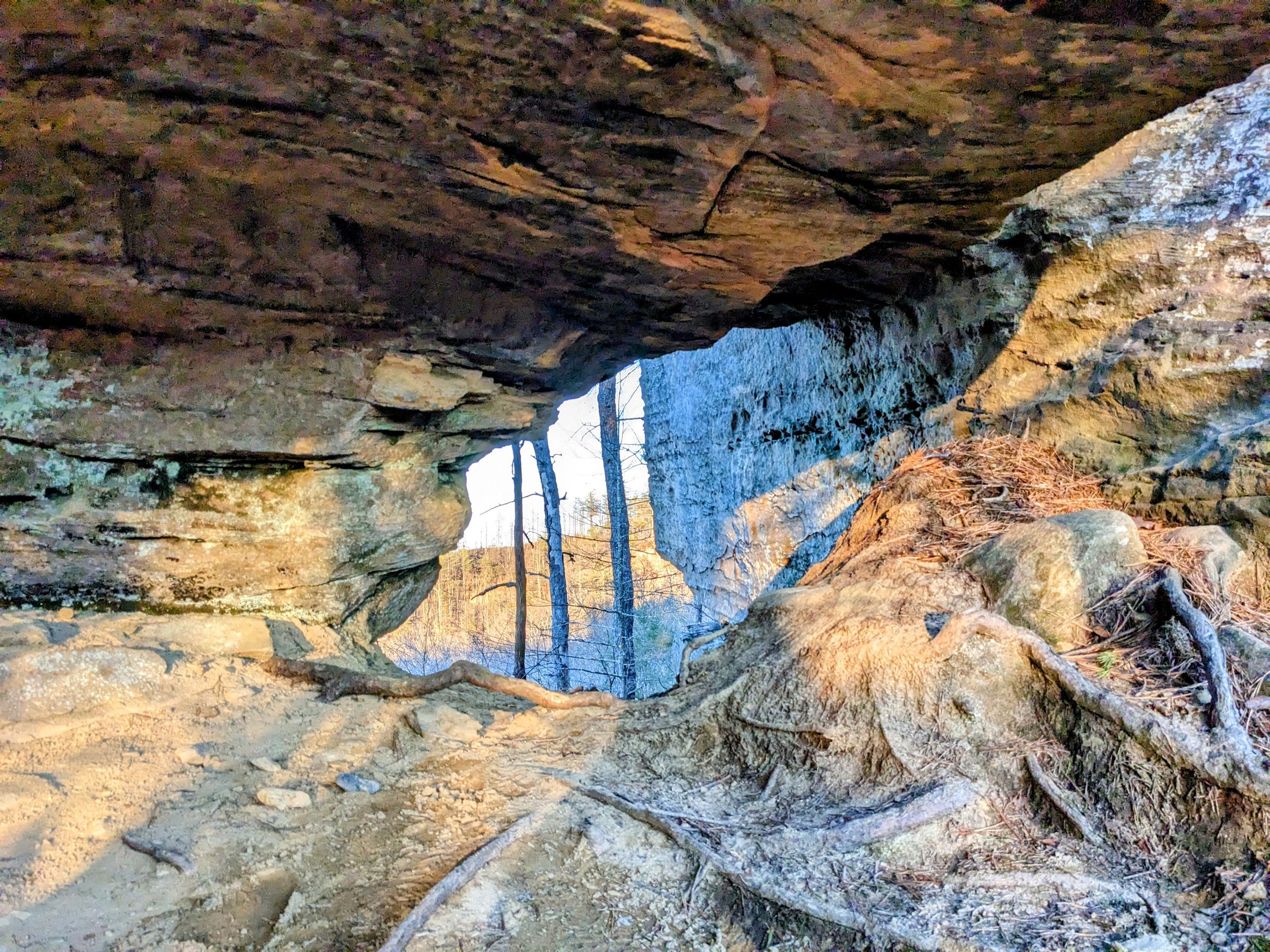
A sandstone window under the top deck behind of Buzzards Roost South
Keystone Arch with my shadow draped across it
Late day view at Buzzards Roost South

Sunset at Buzzards Roost South