Trap Door Arch Out and Back

Map of Trap Door Arch Out and Back, Red River Gorge

Elevation Profile of Trap Door Arch Out and Back, Red River Gorge
Overview. This arch sits about 15-20 feet above the viewing deck and is formed by a collapsed section of rock that sits high above the Osborne Bend Parking Lot. The rock layer forming the arch is reminiscent of Ramp Arch or Cascade Natural Bridge, as it appears to separate from the main outcropping. This would be interesting to climb with proper safety gear.
Route Type | Out and Back
Total Distance | 0.47 miles
Elevation Gain | 131 feet
Overall Difficulty | Easy with Class 2 Scrambles
this hike is unmarked and unmaintained, but relatively easy to navigate
GPS Waypoints
Osborne Bend East Trailhead | 37.820244, -83.574869
Trailside Boulder | 37.821236, -83.573278
513 Graffiti | 37.821414, -83.573656
Trap Door Arch | 37.821989, -83.572967
Red River Gorge Area Map
Parking. A good number of parking spaces are available at the trailhead and along the road, but this area fills up on busy weekends thanks to a number of great hikes that start here. Do NOT park in designated emergency vehicle spaces, as search and rescue operations are popular from this trailhead. Pit toilets and trash receptacles are available here.
Trail Navigation. Though this hike uses unmarked, unmaintained trails, it is easy to navigate. Locate the official trailhead and move your eyes left to find the next two drainages. Pick one and walk steeply uphill until reaching a less taxing grade on old forest road. Continue walking the roadbed until reaching a large, distinct boulder. Turn left (northwest) here and follow the single track user trail to the cliffline. Explore the rock shelter, illegal campsite, and moronic graffiti here before heading around the cliff face northeast and circling around slightly before arriving beneath Trap Door Arch. Take in the sights here and retrace your steps to return to the parking lot.
RULE REMINDER - No Camping within 100 ft. of Rock Shelters. All campsites beneath rock shelters and arches are illegal. In Red River Gorge, whitehair goldenrod is endemic - meaning it is found nowhere else on Earth - and it grows beneath rock shelters and arches. Be sure to NEVER, EVER camp or hike through these sensitive areas.
HIKER NOTE - Climbing. There appears to be a do-able route up and through the arch, so maybe we’ll come back with full safety gear someday down the road.
CAUTION - Poisonous Snakes. Copperheads and timber rattlesnakes can be found in the area. Should you encounter one, stop and slowly back away. Always give venomous snakes a wide berth. Know Before You Go => University of Kentucky Venomous Snake Guide
CAUTION - Black Bears. Ursus Americanus - a.k.a. the American black bear is growing in population throughout much of Kentucky. Know Before You Go => US Forest Service Black Bear Safety Tips

Osborne Bend Info Kiosk (fore left) and Trailhead (back right)

Old Forest Roadbed

Turn Left (northwest) Here

Graffiti Zone and Illegal Campsite

Approach View of Trap Door Arch

Zoom View of the Opening

Looking Out Through Clifty Wilderness
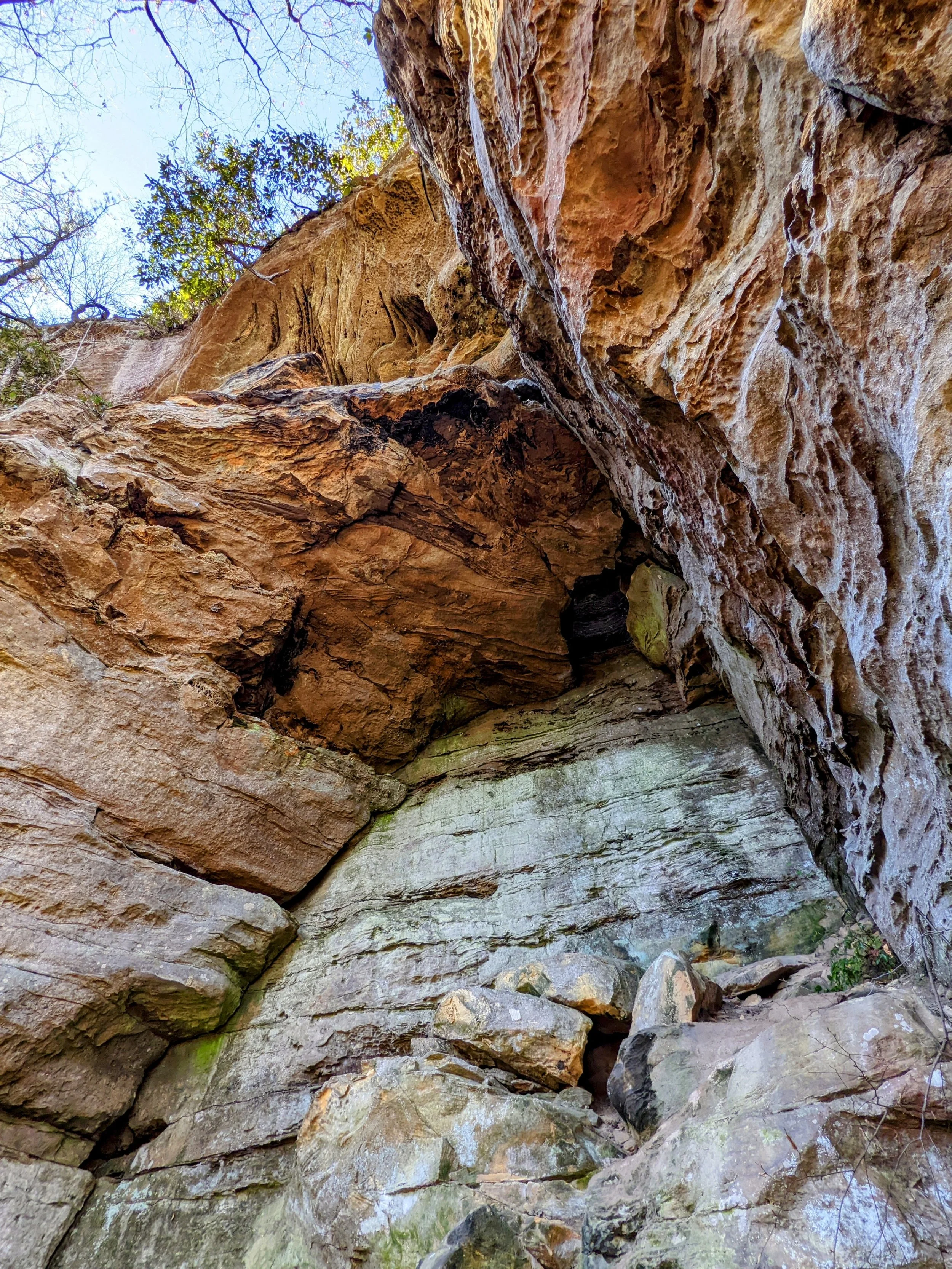
Looking Up at Arch Superstructure