Catawba Overlook the Easy Way

Map of Catawba Overlook Easy Route, Big South Fork NRRA

Elevation Profile of Catawba Overlook Easy Route
Overview. This is the easiest route to a nice overlook with a fine view of Blue Heron Mining Community down below. The trail is partially shared with horses and is a little mucky even after a few dry days. When wet, head to the waterfalls a little further along the trail - see notes below.
Route Type | Out and Back
Total Distance | 1.23 miles
Elevation Gain | 157 feet
Physical Demand | Easy
Navigation Skill | Beginner
GPS Waypoints
Trailhead | 36.662075, -84.549419
First Junction | 36.662233, -84.547433
Kentucky Trail Junction | 36.662339, -84.547603
Catawba Overlook | 36.665358, -84.543628
Big South Fork NRRA Area Map
Blue Heron Area Map
Parking. Limited parking is available at the trailhead. The road is in pretty good shape with a few bumpy spots in the final quarter mile to the parking area.
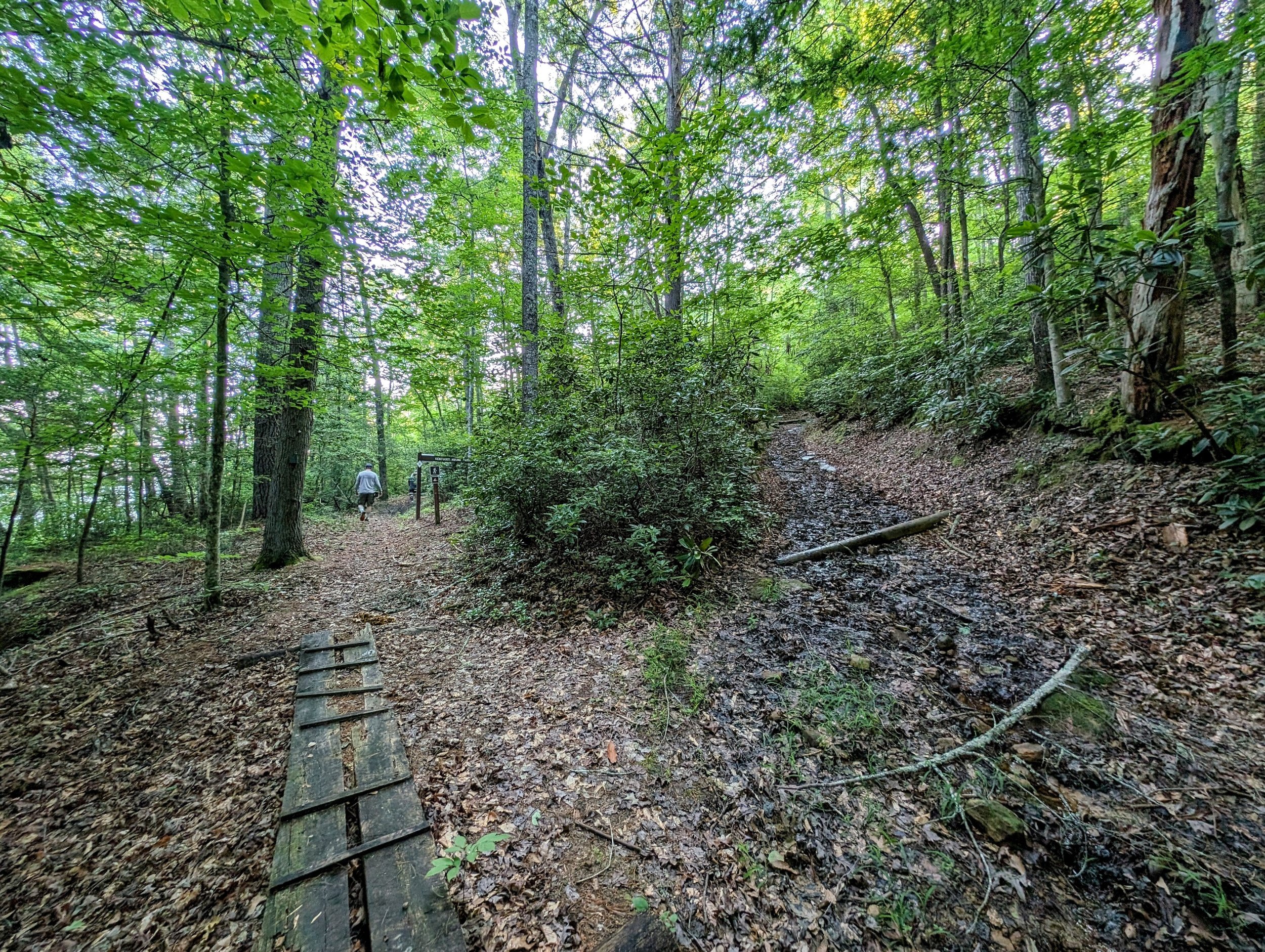
Trail Navigation. Begin at the end of the road and pass the gate down doubletrack horse trail. Stay left at the fork and continue downhill until reaching the next intersection where you’ll turn sharply to the right on the Kentucky Trail/Sheltowee Trace. Meander along the hillside and reach the overlook via a short spur downhill on your left. Retrace your steps to return to the trailhead.
HIKER NOTE - Waterfalls Nearby-ish. When hiking after good rainfall, there are two waterfalls beyond Catawba Overlook - Dick Gap and Big Spring Falls. Follow the Kentucky Trail/Sheltowee Trace out to reach them at the GPS waypoints below. Each are off short spurs from the main trail and are marked. It was dry on our visit, so we skipped them. Hiking all the way out and back to Big Spring Falls adds about 4 total miles to the route.
Dick Gap Falls | 36.663546, -84.538070
Big Spring Falls | 36.655615, -84.547016
HIKER NOTE - Bridge Out, Horse Trail, River Ford. The bridge was out on our visit and that may be the case for a good while. This trailhead should be busier with visitors that might otherwise hike up from Blue Heron. There is a closed horse trail that drops down to the river and crosses. On our visit, water levels were low, and this would be low-shin-deep. NEVER ford the river when its deep and fast moving.
CAUTION - Deadly Drops. Long falls from high places are the #1 non-health related cause of death for hikers in Kentucky. Keep your distance from the edges of cliffs to avoid a deadly fall. Young children should be kept close.
CAUTION - Poisonous Snakes. Copperheads and timber rattlesnakes can be found in the area. Should you encounter one, stop and slowly back away. Always give venomous snakes a wide berth. Know Before You Go => University of Kentucky Venomous Snake Guide
CAUTION - Black Bears. Ursus Americanus - a.k.a. the American black bear is growing in population throughout much of Kentucky. Know Before You Go => US Forest Service Black Bear Safety Tips

Trailhead to Catawba Overlook and More

Stay left at the first fork; even without a map, notice the well trod path on the left, whereas the right side has branches signaling that’s not the right path
This is the sharp turn; horse trail that you descend, then a sharp right onto hiker-only trail

This is the Kentucky Trail and part of Sheltowee Trace

Last turn to the overlook

Long falls from high places remains the #1 cause of death outside of health related issues

View from Catawba Overlook with Blue Heron Overlook across the river